
A powerful offshore magnitude 7.8 earthquake struck the southern Philippines early Monday, killing at least four people, injuring more than 200 others, and damaging buildings and infrastructure in a major southern city. The quake also triggered a small tsunami that sent waves up to 1 meter (3 feet) onto nearby coastal areas.
Authorities said the quake damaged structures, including a key access bridge in a large city in Mindanao, while aftershocks continued to rattle the region.
President Ferdinand Marcos Jr. urged residents in coastal and low-lying areas to move to higher ground as tsunami warnings were issued across parts of the Philippines and extended to nearby Indonesia and Malaysia.
The Pacific Tsunami Warning Center later said the immediate tsunami threat had largely passed about five hours after the quake struck at 7:37 a.m. local time. However, it cautioned that sea levels could continue to fluctuate for several hours and advised residents to remain alert and follow local guidance.
The quake, the strongest to hit the country this year, was centered offshore about 13 kilometers (8 miles) southwest of General Santos, a city of more than 700,000 people and a key hub for tuna processing and trade in southern Mindanao.
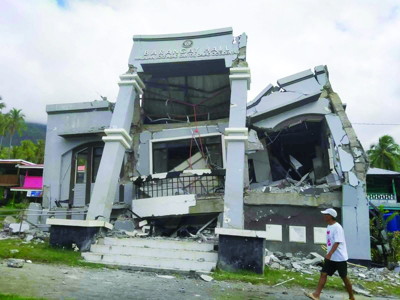
Officials said at least three people were killed and 130 injured in General Santos alone, where several small buildings partially collapsed and others, including a major bridge, developed large cracks. Another fatality was reported in Davao Oriental province, according to the Department of Health.
Emergency officials reported widespread panic across schools, with more than 100 students in several areas sustaining bruises or fainting during morning assemblies.
The international airport in General Santos was temporarily closed following the quake, leading to the cancellation of 17 domestic flights, according to civil aviation authorities.
Local media reported that a small commercial building housing a provincial radio station partially collapsed, though staff evacuated without injuries. Debris from other buildings also fell onto parked vehicles.
The Philippine Institute of Volcanology and Seismology said the quake was caused by movement along the Cotabato Trench at a depth of 10 kilometers (6.2 miles). Its director, Teresito Bacolcol, warned that additional damage was expected as assessments continued.
Waves of about 1 meter were recorded in parts of Sultan Kudarat and Sarangani, while smaller sea level changes were detected in other coastal provinces. Indonesia reported an 83-centimeter (2.7-foot) wave off Sulawesi.
The U.S. Geological Survey recorded aftershocks as strong as magnitude 6.5, while noting some variation in early readings, including a different depth estimate for the main quake.
The Pacific Tsunami Warning Center said minor sea fluctuations could also affect parts of Papua New Guinea and other areas of the western Pacific, though no tsunami threat was issued for Hawaii.
The Philippines lies along the Pacific “Ring of Fire,” a seismically active zone where earthquakes and volcanic eruptions are common. The country is also regularly struck by about 20 typhoons and tropical storms each year, making it one of the world’s most disaster-prone nations. (FROM THE WIRES)


